WSV3 - The new standard in real-time PC weather software
Professional Weather Graphics
Real-time data visualization • High-performance rendering
The Ultimate Swiss Army Knife of Weather Software
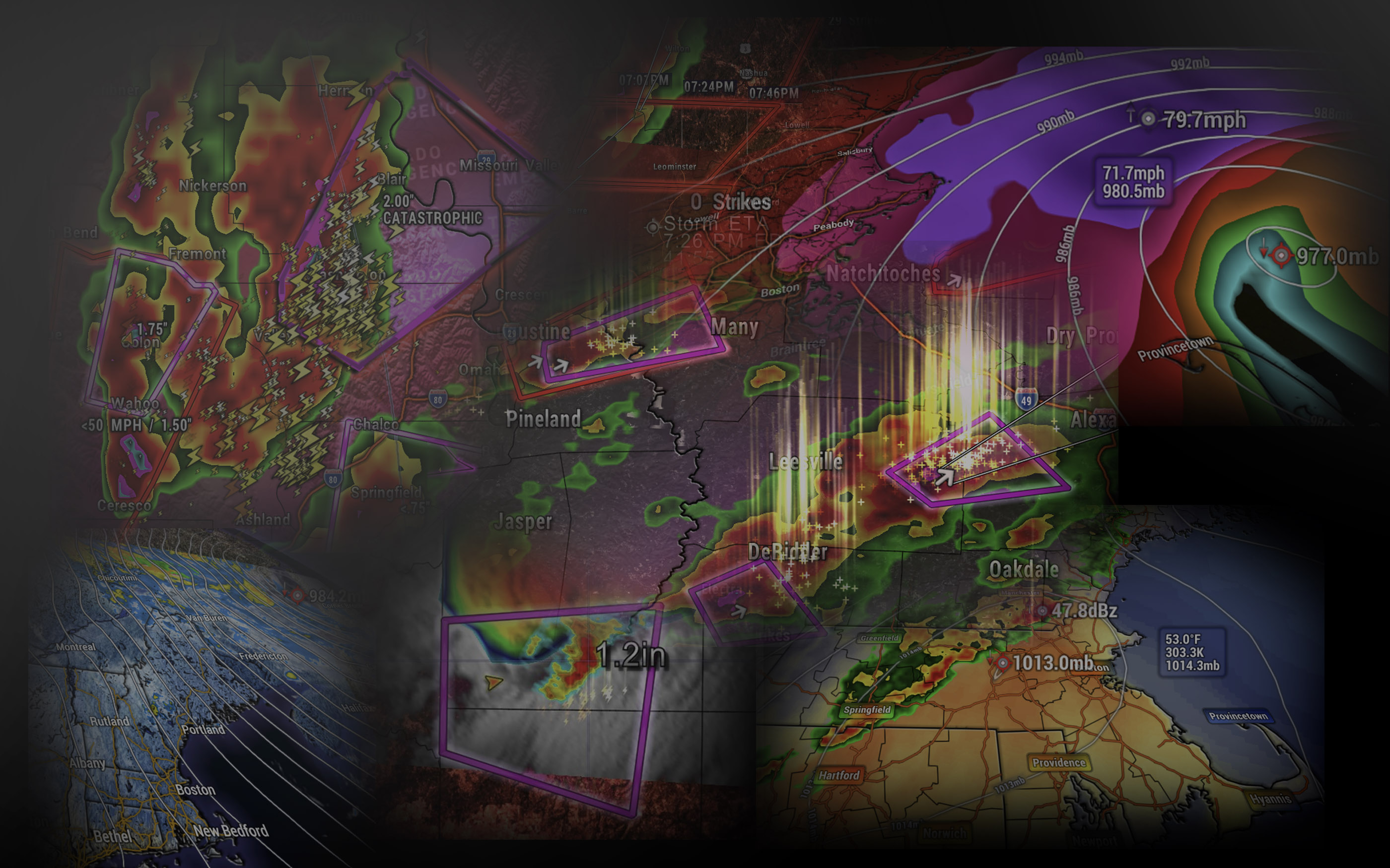
The culmination of 10 years of experience in developing high-performance PC weather software, listening to our clients' innovative ideas for improvement, and striving to be the best there is: WSV3 - the ultimate Swiss army knife of live weather tracking/monitoring information, set to shockwave through all its target industries - from TV broadcasting, emergency management, and storm-chasing to personal safety, insurance, utility management, construction safety, DOT operations and more.
V6 Prototype Experimental Build
The next-generation of WSV3 looms on the horizon.
See video: "WSV3 founder Paul Maravelias narrates visual update on March 2023 V6.0 development progress." (March 30th, 2023)
Advanced Graphics Engine
GPU-based rendering • Real-time performance
Enhanced Capabilities
60 FPS performance • AAA game-quality graphics
"WSV3 V6 Prototype", an experimental concept build in development since October 2022, is a recontemplation and thorough re-engineering of WSV3 as high-performance Windows PC weather graphics software. Progress on this new, groundbreaking geospatial display engine for WSV3 was made available in May 2023 as an experimental build. This work will be continued in a next-generation WSV3 replacement product slated for late 2025. The experimental build remains available to all current WSV3 Professional users and can remain installed along with the release version as separate applications.
Engineered for Professional Performance
Three core innovations that set WSV3 apart from traditional weather visualization software
Modern Product for Modern Hardware
3D GIS Mapping System
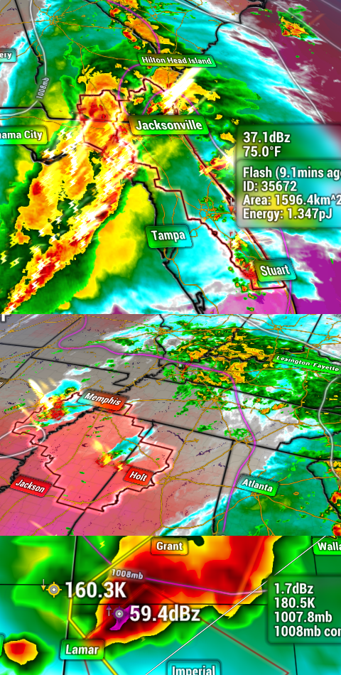
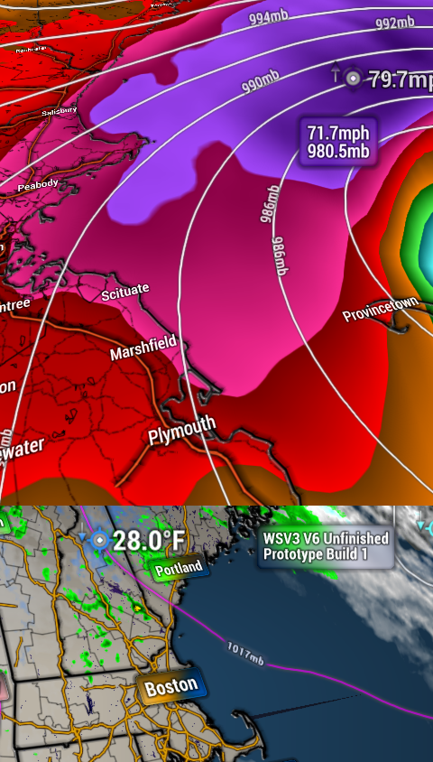
WSV3's dynamic 3D GIS mapping system is one of only a few in the world to ingest and style ESRI Shapefile data at the user's configuration and display it with hardware-accelerated, fluid graphics.
Built-in street level mapping, road sign labeling, and standard GIS layers give users a crystal clear sense of weather and geographical space. Old, sluggish WeatherStudio has been blown out of the water.
Lightning-fast Server-backed Data
Cloud-Based Imagery Streaming
Many WSV3 data layers are backed by our new (2021) high-performance cloud-based imagery streaming service. You don't have to pay extra for this; it's built-in.
High-resolution GOES-R imagery loops download an order of magnitude faster than direct client-side raw government data access. You'll be shocked by the speed.
WSV3 is the only Windows weather graphics software delivering live-updating temporally interpolated multispectral GOES-R colorized RGB products using smooth, performant GPU rendering.
Quality Engineered for High-Performance
Unified Timeline System
WSV3 employs a single, unified timeline system that links together, synchronizes, and smoothly animates all loaded data layers. No more confusing management of loading/freeing different loop layers.
Our state-of-the-art graphics technology can display 10 times as much vector and raster data as WeatherStudio - faster.
A fine-tuned, multi-threaded raster data system joins an industrial-grade vector graphics layer to bring TV broadcast quality graphics to any standard consumer PC.